
Quick answer
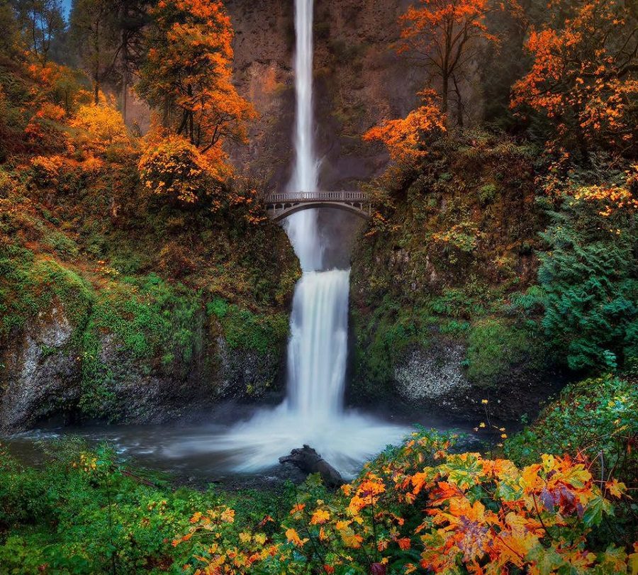
The Columbia River Gorge contains approximately 90 named waterfalls and more than 200 seasonal cascades, depending on rainfall and snowmelt. Roughly 77 of the named falls flow year-round, fed by persistent springs and basalt aquifers, while the remainder emerge during spring runoff or heavy autumn storms. Multnomah Falls, Horsetail Falls, and Latourell Falls anchor the western corridor; the eastern gorge near Hood River shelters lesser-known perennial cascades that remain accessible when the Historic Columbia River Highway reopens after closures.
The gorge's waterfall density stems from its geological architecture: the Columbia River sliced through fifteen distinct basalt flows, each separated by softer soil layers that erode at different rates, creating the stepped cliffs that force tributary creeks into freefall. Oneonta Creek alone generates five named waterfalls within two miles, and the basalt plateau above Multnomah Falls releases groundwater through fractures that sustain flow even in August. How many waterfalls are in the Columbia River Gorge depends on the season and the definition applied. The U.S. Forest Service counts 77 year-round falls with individual names, but hydrologists working in the Mark O. Hatfield Wilderness have cataloged more than 200 distinct vertical drops during peak runoff, many of them unnamed ephemeral ribbons visible only from May through June. The western corridor between Bridal Veil and Cascade Locks holds the highest concentration—Multnomah, Wahkeena, Horsetail, Ponytail, Latourell, Bridal Veil, Coopey, Elowah, and Oneonta are all reachable within a ten-mile stretch of the Historic Columbia River Highway. Counting Columbia River Gorge waterfalls depends on whether you include seasonal seeps, side-canyon tributaries, and post-storm ephemeral drops. The tallest named cascades—Multnomah at 620 feet, Fairy Falls at 186 feet, and Tunnel Falls at 120 feet—flow year-round and appear on every published trail map. Smaller falls like Wiesendanger and Dutchman require short hikes from established trailheads, while accessing remote seasonal cascades in the Eagle Creek drainage or Herman Creek corridor demands backcountry navigation and trail permits during fire season. Most visitors concentrate on the western corridor accessible from Interstate 84, where roadside pullouts and paved paths lead to ten major waterfalls within thirty minutes of Portland. The eastern gorge waterfalls near Mosier and Hood River receive fewer visitors but offer equivalent scenery, particularly during wildflower season when lupine and balsamroot frame the basalt cliffs. Seasonal closures following the 2017 Eagle Creek fire have reopened incrementally, restoring access to Punch Bowl Falls and Tunnel Falls as of 2025, though trail conditions and permit requirements shift each season.
“The Columbia River sliced through fifteen distinct basalt flows, each separated by softer soil layers that erode at different rates, creating the stepped cliffs that force tributary creeks into freefall.”
Answering How Many Waterfalls Are In The Columbia River Gorge
The Columbia River Gorge contains a high concentration of waterfalls, though an exact total remains difficult to define due to the ephemeral nature of many smaller cascades. The following facts provide context on the scale and classification of these natural features.
90+ officially documented falls
While estimates vary, researchers have identified over 90 named waterfalls within the Columbia River Gorge National Scenic Area on the Oregon side alone.
Ephemeral waterfall classification
Many waterfalls in the region are considered ephemeral, meaning they only flow during periods of significant rainfall or snowmelt and disappear during drier months.
National Scenic Area scope
The Columbia River Gorge National Scenic Area spans 292,000 acres, encompassing diverse terrain that supports varying hydrological conditions for waterfall formation.
Geological history
The unique basalt layering of the Gorge, formed by ancient volcanic activity and subsequent glacial flooding, creates the sheer cliff faces necessary for waterfall development.
Multnomah Falls height
Multnomah Falls stands as the tallest waterfall in Oregon, with a total drop of 620 feet measured across its two main tiers.
Year-round accessibility
While many falls are seasonal, several major landmarks, including Multnomah Falls, are fed by underground springs, ensuring consistent water flow throughout the year.
Waterfall density comparison
The Gorge is recognized for having one of the highest concentrations of waterfalls in North America, particularly within the stretch between Corbett and Dodson.
Key Sightings When Learning How Many Waterfalls Are In The Columbia River Gorge
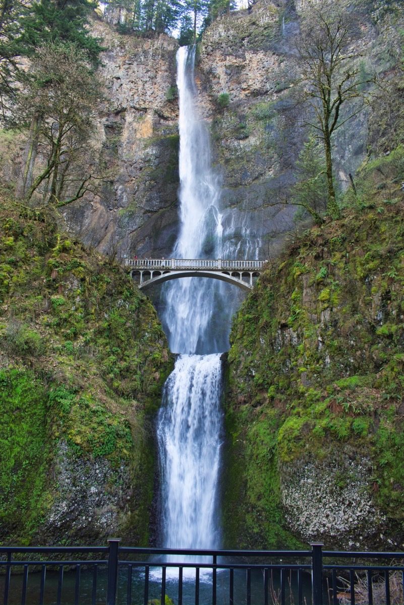
Multnomah Falls consists of two distinct tiers that create a combined drop of 620 feet. These sections are separated by a central pool and connected by a historic walking path.
Upper Tier
The upper cascade falls 542 feet from the top of the cliff into the middle basin. This portion of the falls is best viewed from the base or the lower trail sections.
View from the base to capture the full height.
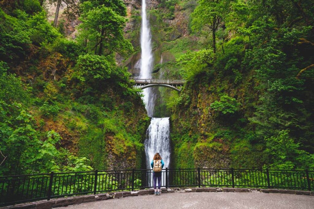
Benson Bridge
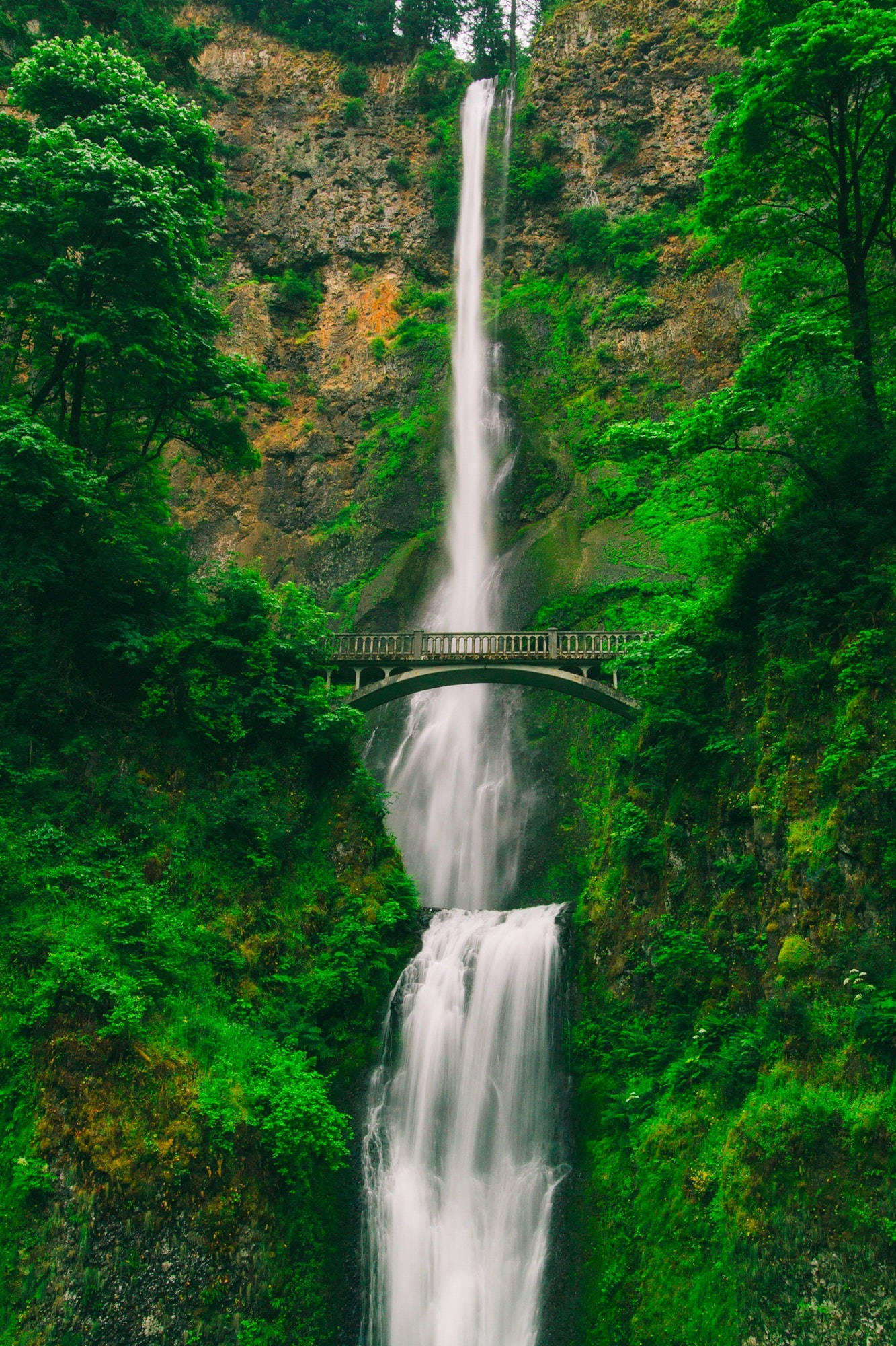
This stone arch bridge sits at the 105-foot level, crossing the space between the upper and lower tiers. It was constructed in 1914 and provides a direct vantage point of the waterfall's path.
Walk to the center for a centered perspective of the falls.
Lower Tier
The lower cascade drops 69 feet from the middle basin into the final pool near the visitor area. This section is easily accessible from the primary viewing plaza.
Position yourself at the plaza for a clear lower view.
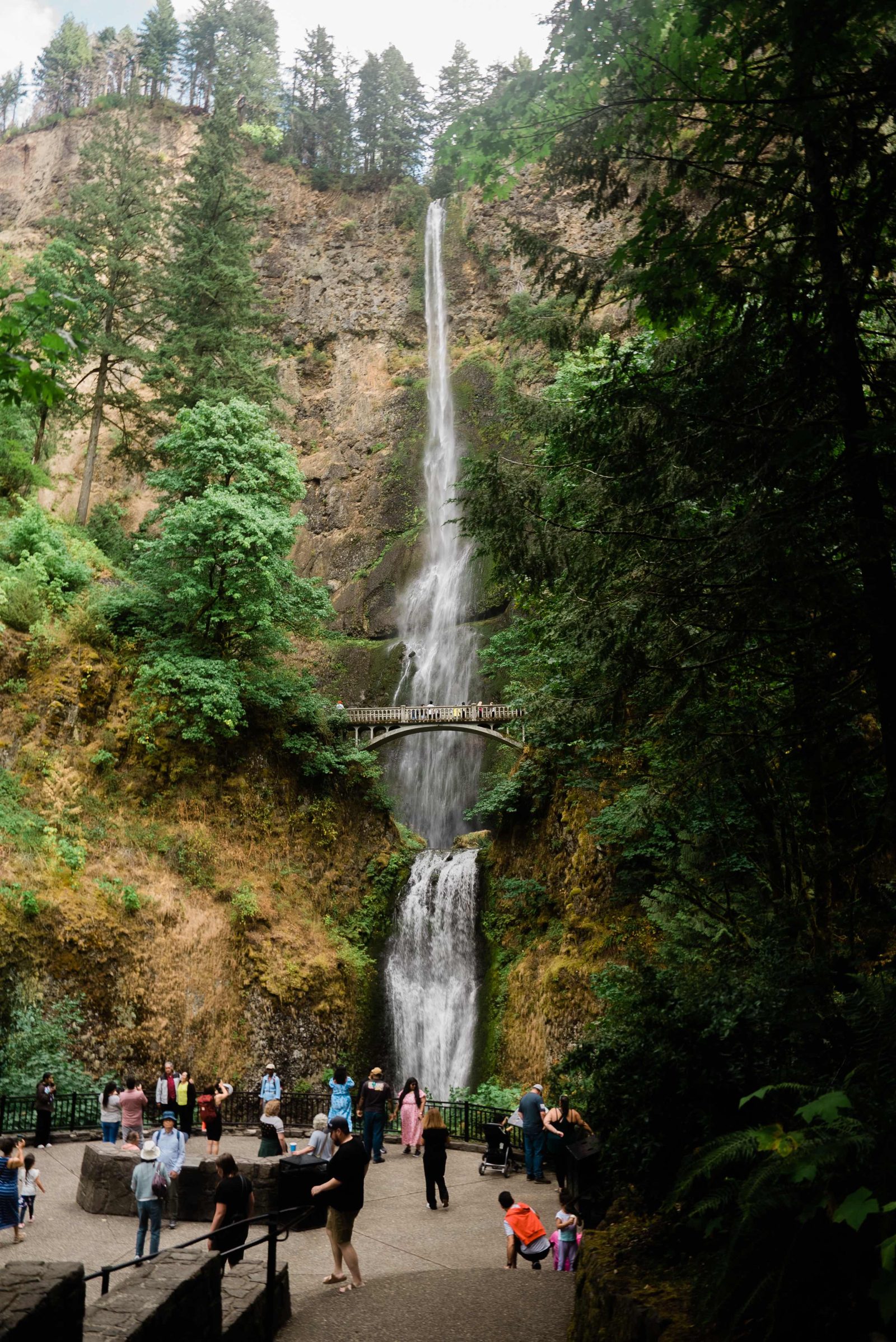
Viewing Plaza
Located at the foot of the trail, this area provides the primary perspective for both tiers of the waterfall. It serves as the main gathering point for visitors arriving from the historic highway.
Arrive early to secure a clear spot without crowds.
Optimal Timing To Experience How Many Waterfalls Are In The Columbia River Gorge
The best arrival window is 06:00–08:59 to avoid peak crowds and heat while securing easier parking. Visiting during shoulder seasons balances accessible traffic levels with moderate temperatures.
Weekday mornings
Low to moderate—
Visit early to secure parking before daily permit requirements and peak visitor volume begin.
Late Spring (May-June)
HighMild, 50°F-70°F
Expect higher water flow and significant visitor traffic during these months.
Summer (July-August)
Very HighWarm, 70°F-85°F
This period experiences the highest visitation levels and warmest conditions in the Gorge.
Autumn (September-October)
ModerateCool, 45°F-65°F
Crisp temperatures and reduced crowd density make this a favorable time for site exploration.
Verdict: The best time to visit is Tuesday to Thursday between 06:00–08:59 during the months of April or October.
Operating Schedule For Seeing How Many Waterfalls Are In The Columbia River Gorge
Multnomah Falls is open to visitors daily throughout the week, including weekends.
| Monday | 00:00–23:59 | |
|---|---|---|
| Tuesday | 00:00–23:59 | |
| Wednesday | 00:00–23:59 | |
| Thursday | 00:00–23:59 | |
| Friday | 00:00–23:59 | |
| Saturday | 00:00–23:59 | |
| Sunday | 00:00–23:59 |
Entrance Fees And How Many Waterfalls Are In The Columbia River Gorge
Entry to Multnomah Falls is free of charge for all visitors. Costs associated with visiting the site typically relate to parking arrangements rather than standard admission fees.
A typical adult pays 0 USD for admission, though visitors arriving by personal vehicle during the peak season must secure a timed-use parking permit.
Navigating To See How Many Waterfalls Are In The Columbia River Gorge
Multnomah Falls is located at 53000 E Historic Columbia River Hwy, Bridal Veil, OR 97010, within the Columbia River Gorge. The most direct approach from Portland is via Interstate 84.
I-84 East to Exit 31
Columbia Gorge Express to Multnomah Falls stop
Other Sights Near How Many Waterfalls Are In The Columbia River Gorge
The Columbia River Gorge contains a high concentration of waterfalls located along the Historic Columbia River Highway. Exploring these sites in sequence allows visitors to see various geological features within a short driving distance.
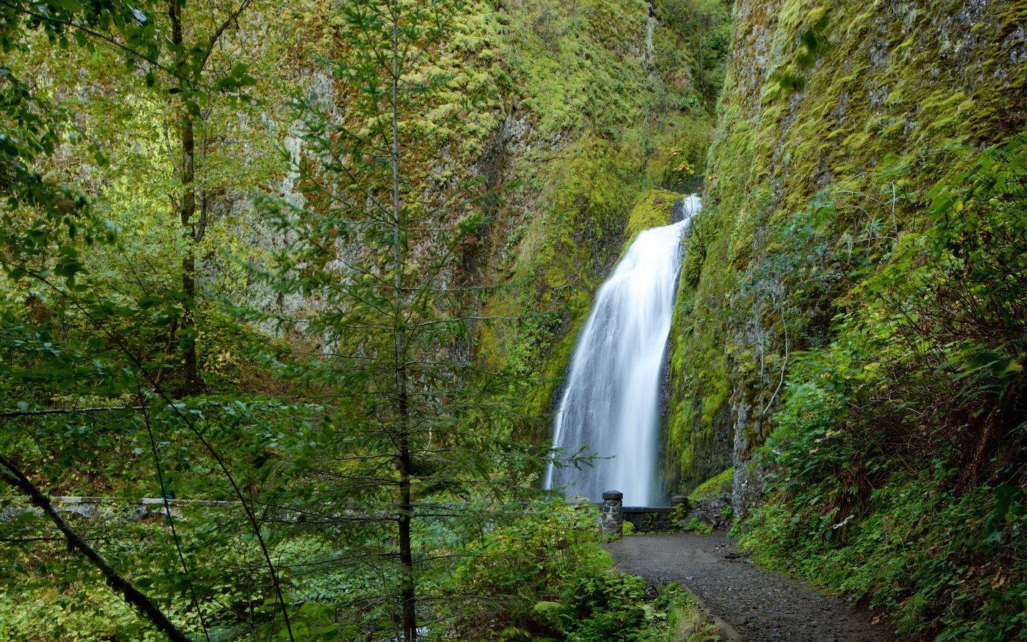
Wahkeena Falls
Located just a short distance away, this waterfall offers a tiered appearance and is often included in the same outing due to its proximity to Multnomah Falls.
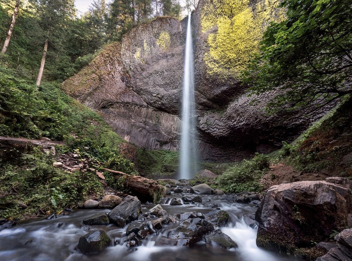
Latourell Falls
This waterfall drops over a sheer basalt cliff, providing a different perspective on the volcanic history of the region compared to nearby sites.
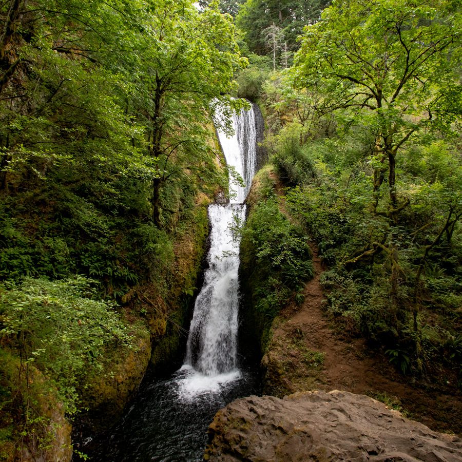
Bridal Veil Falls
A short trail leads to this two-tiered waterfall, which serves as a quiet alternative to the more heavily visited areas nearby.
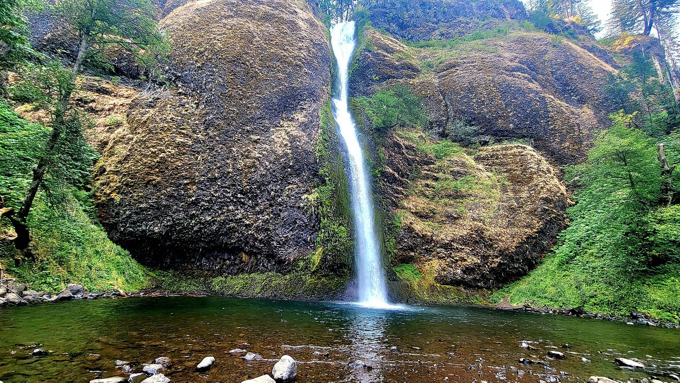
Horsetail Falls
Visible directly from the road, this waterfall is a convenient stop for those touring the multiple cascades found throughout the gorge.
Check availability
Common Questions About Columbia River Gorge Waterfalls
Everything you need to know about how many waterfalls are in the columbia river gorge