
Quick answer
The full Historic Columbia River Highway scenic loop—from Troutdale to Hood River and back via Interstate 84—takes approximately 2.5 to 3 hours of driving time without stops. Most visitors spend 4 to 6 hours in total once you factor in time at Multnomah Falls, Crown Point Vista House, and other viewpoints. Peak-season traffic and parking waits can add another hour during summer weekends.
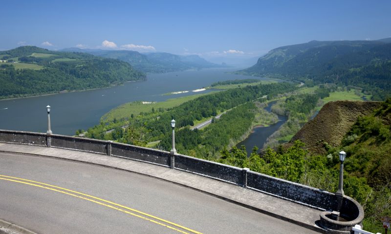
The Historic Columbia River Highway, completed in 1922, was engineered as a scenic marvel—every curve and stone bridge designed to frame the landscape. The route carries you past eleven major waterfalls, forested cliffsides, and panoramic overlooks where the Columbia cuts through the Cascade Range. For drivers accustomed to interstate efficiency, the two-lane road's 25 mph curves and frequent pullouts demand patience, but that deliberate pace is the point. How long does it take to drive the Columbia River gorge depends largely on how you structure the route. The most popular loop begins in Troutdale, follows the Historic Highway east to Multnomah Falls and Crown Point, reconnects briefly with Interstate 84, then continues on the eastern segment through Mosier to Hood River before returning west. Pure drive time sits around 2.5 hours. Add thirty minutes at Multnomah Falls, fifteen at Vista House, and brief stops at Latourell or Horsetail Falls, and you arrive at a four-hour minimum. Serious photographers and hikers often stretch the journey to a full day. Traffic patterns reshape the gorge drive timeline significantly. Summer weekends between May and September bring the heaviest congestion, especially near Multnomah Falls, where parking lots fill by mid-morning and roadside queues form along the highway. Timed-entry parking permits, required from 9 a.m. to 6 p.m. during peak season, help manage the crush but add a planning layer. Early starts—arriving before 9 a.m.—let you move freely and claim parking without competing for space. Midweek autumn visits offer the gorge waterfall route nearly empty, with October foliage adding a layer of gold to the basalt walls. The gorge rewards drivers who treat it as a sequence of micro-destinations rather than a highway to cross. Rowena Crest's wildflower plateaus in spring, the Mosier Twin Tunnels' pedestrian path, and the fruit-stand clusters near Hood River each justify a stop. Attempting the Columbia River scenic highway in under three hours is possible, but the landscape was designed to be consumed slowly. The road itself is the attraction, not merely the route between them.
“The Historic Columbia River Highway was engineered as a scenic marvel—every curve and stone bridge designed to frame the landscape.”
Planning Your Visit: How Long Does It Take to Drive the Columbia River Gorge?
This plan suits travelers driving the Historic Columbia River Highway with a stop at Multnomah Falls. Budget 2–3 hours for the scenic drive alone, or 4–5 hours if you include a hike to Benson Bridge and a meal stop.
Arrive at Multnomah Falls
Park early to avoid permit requirements and crowds that build after 9 a.m. The lower viewing area is immediately accessible from the lot.
Hike to Benson Bridge
The paved trail climbs 0.2 miles to the bridge at the base of the upper tier. Allow 30–40 minutes round-trip, longer during peak traffic.
Drive Vista House & Crown Point
Continue east on the Historic Highway to Vista House for panoramic gorge views. This segment adds 20–30 minutes including a brief stop.
Scenic Drive to Hood River
The eastern stretch passes Horsetail Falls, Oneonta Gorge, and forested bluffs. Drive time is roughly 45 minutes; add stops as desired.
Lunch in Hood River or Cascade Locks
Both towns offer river-view dining and mark natural turnaround points for a half-day loop back to Portland.
When to Avoid Delays: How Long Does It Take to Drive the Columbia River Gorge in Peak Season?
To minimize drive times and avoid congestion in the Columbia River Gorge, the best arrival window is 08:00–09:00. Arriving during this period allows you to bypass peak traffic and navigate the area before daily timed-use permit requirements begin.
Summer (June–August)
High; expect significant delaysWarm and dry; 70°F–85°F
Expect heavy traffic on the Historic Highway throughout the day. Early morning arrival is essential for access.
Weekday Mornings
Low to moderate—
Traffic is lightest mid-week. Arriving before 09:00 provides the most consistent travel experience.
Spring and Fall
Moderate; weekend congestionCool to mild; 50°F–70°F
Shoulder seasons offer relief from summer volume, though weekends remain busy. Aim for mid-week travel for fewer delays.
Winter
LowCold; 35°F–45°F
Travel times are generally predictable, though road conditions can change rapidly due to ice or snow.
Verdict: For the most efficient visit, plan your trip for a Tuesday to Thursday between 08:00–09:00 during the months of April, May, September, or October.
Navigating the Route: How Long Does It Take to Drive the Columbia River Gorge from Portland?
Multnomah Falls is located at 53000 E Historic Columbia River Hwy, Bridal Veil, OR 97010. The most direct driving route from Portland involves taking I-84 East toward the Columbia River Gorge.
I-84 E to Exit 31
Columbia Gorge Express to Multnomah Falls
Operational Schedule: How Long Does It Take to Drive the Columbia River Gorge Access Points?
Multnomah Falls operates on a set schedule throughout the week to accommodate visitors traveling through the Columbia River Gorge. Please plan your visit to align with these daily operational hours.
| monday | 09:00–18:00 | |
|---|---|---|
| tuesday | 09:00–18:00 | |
| wednesday | 09:00–18:00 | |
| thursday | 09:00–18:00 | |
| friday | 09:00–18:00 | |
| saturday | 08:00–18:00 | |
| sunday | 08:00–18:00 |
Entry Requirements: How Long Does It Take to Drive the Columbia River Gorge Including Permits?
Admission to Multnomah Falls is free, though travel time and trip planning may be influenced by mandatory parking permits during the peak season. Visitors should account for these logistical requirements when budgeting their time for the Columbia River Gorge.
A typical adult pays 0 USD for entrance, though a timed-use parking permit may be required to access the site during peak seasons.
Extending Your Trip: How Long Does It Take to Drive the Columbia River Gorge and Nearby Sights?
To calculate total driving time, consider adding these nearby stops along the Historic Columbia River Highway. These locations allow for a logical flow when exploring the waterfall corridor.
Latourell Falls
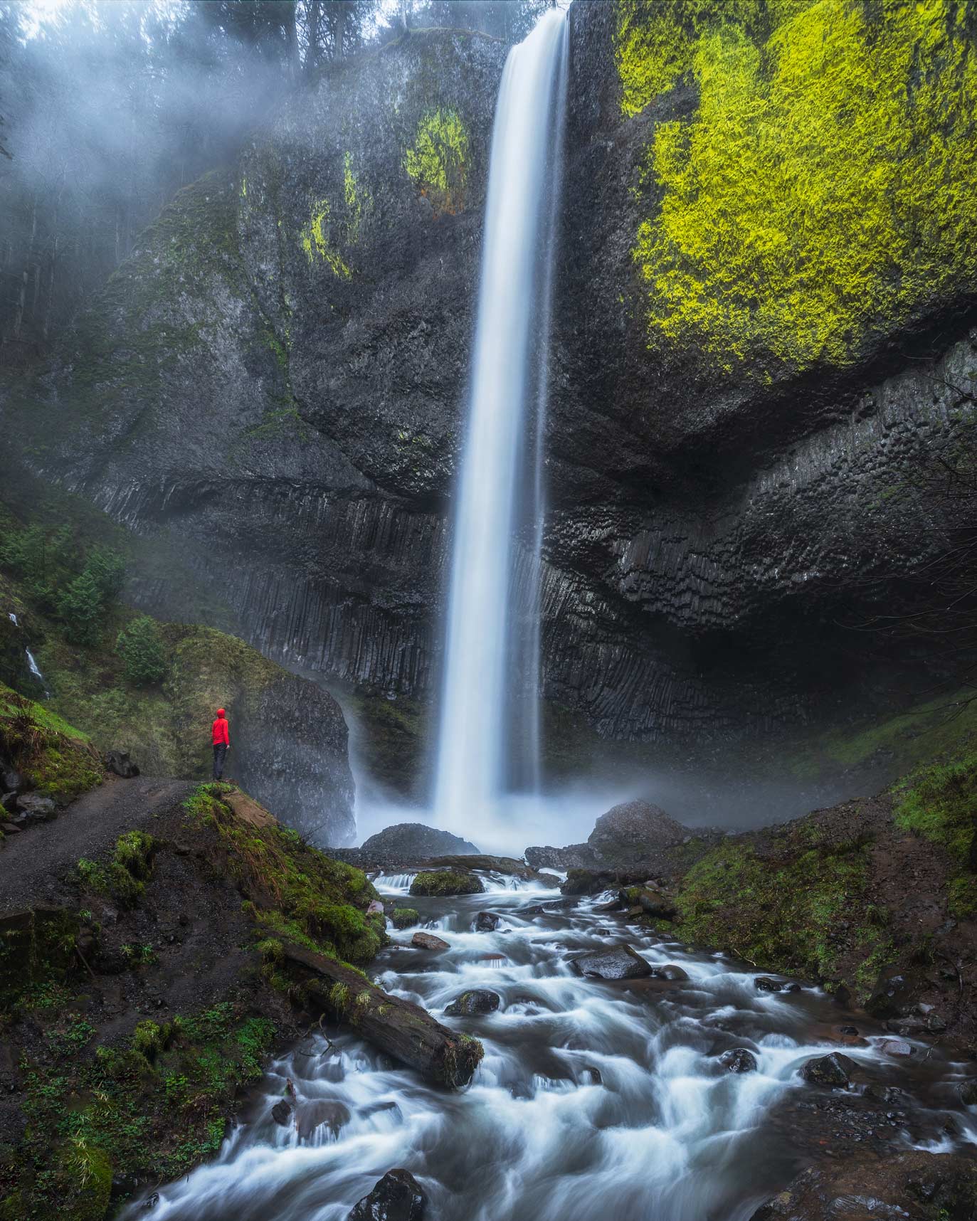
This stop features a distinct basalt cliff formation and a shorter trail loop that complements the taller Multnomah Falls.
Wahkeena Falls
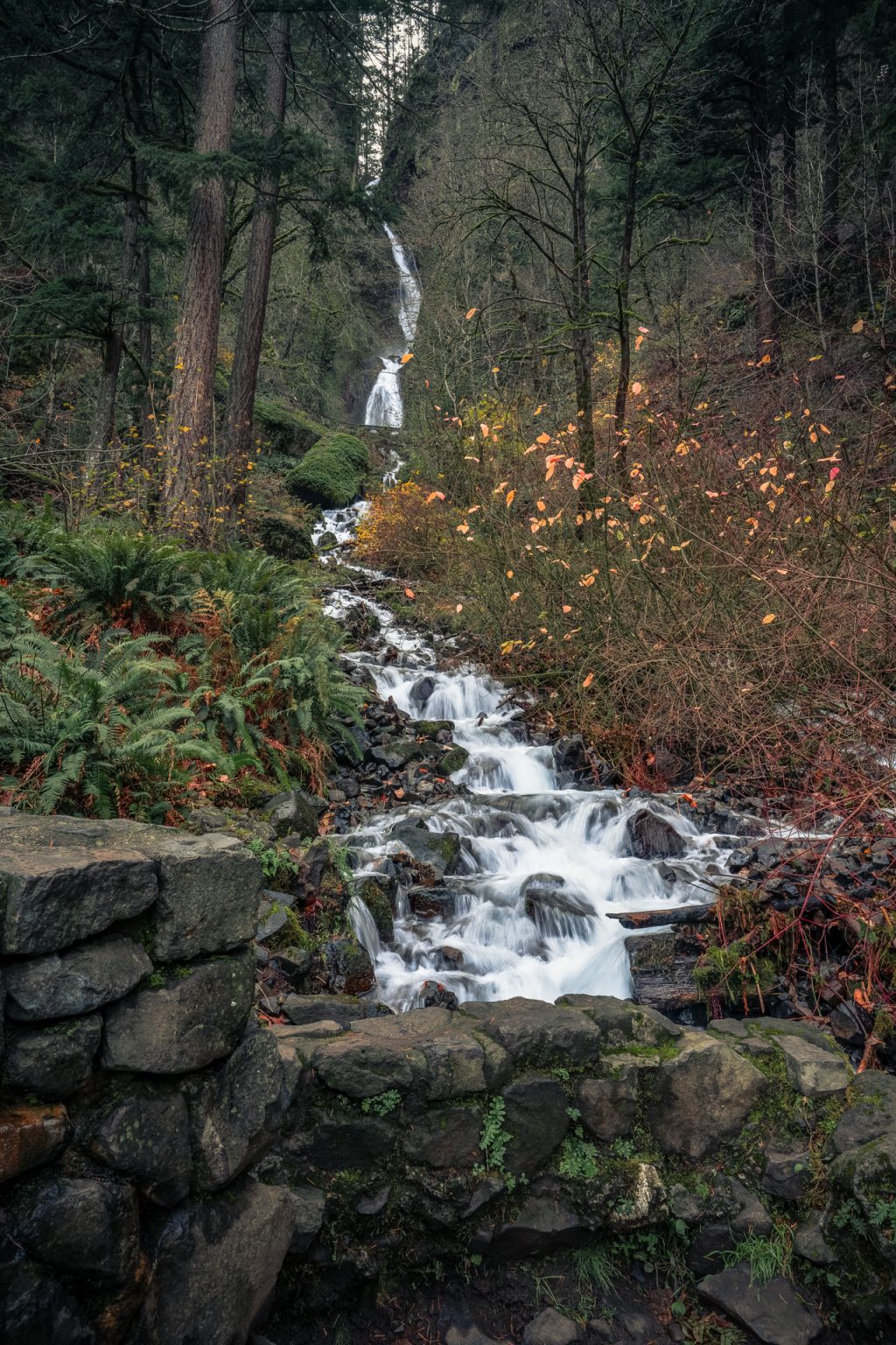
Located in close proximity, this waterfall offers a tiered cascade that provides a quieter experience than the main site.
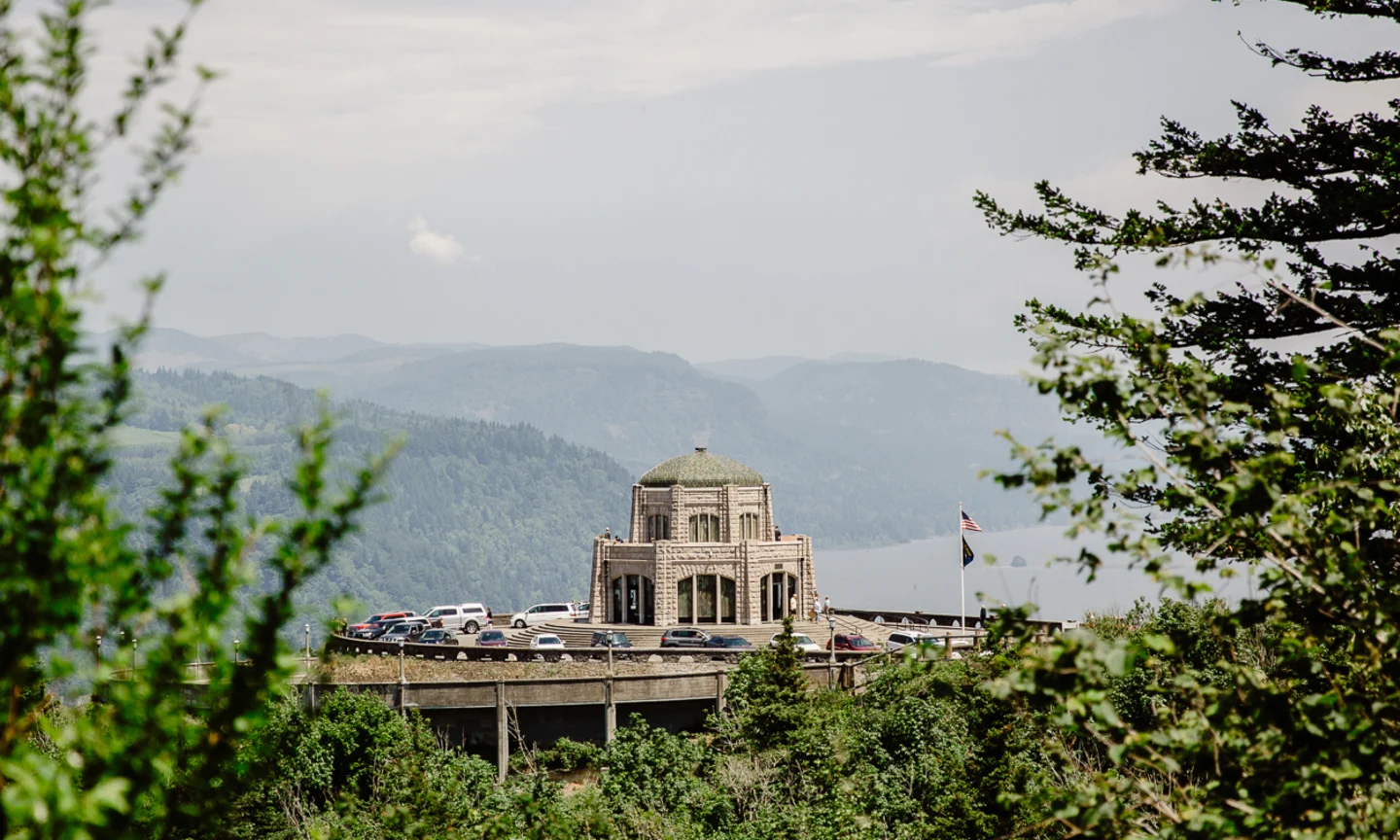
Vista House
Perched on a cliff, this historic structure offers expansive views of the river and serves as an ideal orientation point for your drive.
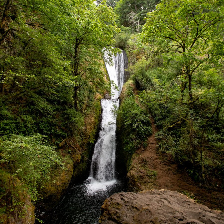
Bridal Veil Falls
This short, accessible trail adds a modest amount of time to your itinerary while offering a different perspective on the gorge geology.
Check availability
FAQs: How long does it take to drive the Columbia River Gorge?
Everything you need to know about how long does it take to drive the columbia river gorge